
Lakes, parks, trails and boulder fields offer a wide range of experiences
ABINGDON, VIRGINIA–FEBRUARY 2025–Southwest Virginia is known as a place to enjoy the outdoors. As the state with more miles of the Appalachian Trail than any other, it’s no wonder. What is more surprising to many is the variety of outdoor opportunities for all ages, all skill levels and so many interests. Throughout the 19 counties and 8,600 square miles of this diverse region there are state parks, wildlife management areas, hiking trails, biking trails, lakes and more. And, located within a day’s drive of more than half of the United States population, Southwest Virginia is a playground for both those who want to get away with the family and those who want to take on some hard-core adventure.
Generational fun
Hungry Mother State Park (2854 Park Boulevard, Marion, Virginia 24354; 276-781-7400) is one of Virginia’s most popular parks for family getaways and Hungry Mother Lake is its centerpiece. The sandy beach and iconic dive tower are the most recognizable features of the 108-acre lake, but fishing and boating are popular here, too. Canoe, kayak and paddleboard rentals are available, too. On land, there are more than 17 miles of trails, including the Kids in Parks Track Trail, a .6-mile paved trail that helps children and adults learn about various plants and animals in the park. The park also offers a geocaching program that takes guests on a “treasure hunt” and has campsites, yurts and cabins for overnight stays.
Cascades National Recreational Trail (Cascades Day Use Area, 2068 Cascades Drive, Pembroke, Virginia 24136; 540-552-4641) is a beautiful, family-friendly hiking trail that leads to an awe-inspiring waterfall. The scenic, four-mile round trip makes for a moderate hike as it meanders along a shaded mountain creek to a 66-foot waterfall. The trail is in a day use area of the Jefferson National Forest where visitors can also enjoy picnicking and native trout fishing on Little Stony Creek.
New River Trail State Park (116 Orphanage Drive, Max Meadows, Virginia 24360; 276-699-6778) is a 57-mile-long park with a trail for hiking, biking and horseback riding. The gently sloping trail follows an abandoned railroad line and parallels the scenic and historic New River for 39 miles. Bicycle and horse rentals are available at the main entrance at Max Meadows and there are several access points along the trail, including opportunities for fishing and camping in Galax (212 East Stuart Drive, Galax, Virginia 24333; 276-699-6778).
Grayson Highlands: Park Pine Mountain Loop (829 Grayson Highland Lane, Mouth of Wilson, Virginia 24363; 276-579-7092) is a 12-mile loop and whether just for a short out-and-back hike, a full loop hike or an overnight outing, it is an amazing location for breathtaking views and lasting memories. There are numerous campsites as well as wandering wild ponies amid the balds, rock formations and tunnels of Catawba Rhododendrons along the trail. Most of this loop lies outside of the park and within the boundaries of the Mount Rogers National Recreation Area.
Natural Tunnel State Park’s (1420 Natural Tunnel Parkway, Duffield, Virginia 24244; 276-940-2674) namesake is more than 850 feet long and 10 stories high and was naturally carved through a limestone ridge over thousands of years. Park visitors can enjoy a chairlift ride to the tunnel floor, the Wilderness Road historic area, the Cove Ridge Environmental Education Center and a swimming pool with a 100-foot slide. In addition, there are cave tours and canoe trips on the Clinch River.
Adventure seekers
The Heart of Appalachia Bike Route trail runs from Burke’s Garden to Guest River Gorge. The 128-mile ride has 40 miles of side trails and winds through the far southwestern counties of Southwest Virginia. It traverses backroads, rails to trails segments, single track trails, wilderness areas, a swinging bridge and more. Views include historic sites, natural preserves, three scenic rivers, farms and coal country. The route includes several climbs with elevations from 2,821 to 3,960 feet, with a total ascent of 6,585 feet. Cyclists traverse in and out of the Jefferson National Forest. Primitive camping on federal lands is allowed at no cost except where marked prohibited.
Sugar Hollow Park (23261 Sugar Hollow Road, Bristol, Virginia 24202; 276-645-7300) offers urban adventure near downtown Bristol. This 400-acre city park has an abundance of mountain biking trails with varying difficulty, offering both fun and challenge for any skill level. In addition to mountain biking, the recreational opportunities at Flag Rock Recreational Area (Flag Rock Road, Norton, Virginia 24273; 276-679-0754) include hiking, trail running, rock climbing, fishing and kayaking. There’s also a campground located adjacent to the Jefferson National Forest and within a short hike, bike ride or drive from the High Knob summit and observation tower.
The Channels Natural Area Preserve (4250 Hayters Gap Road, Saltville, Virginia 24370; 276-236-2322) is a true hiker’s challenge that is well worth the trek. The journey winds through a maze-like system of sandstone crevices and boulders that occur near the summit of Middle Knob on Clinch Mountain. Along the way, hikers enjoy seeing amazing views, natural wonders, and an old fire tower!
Grayson Highlands State Park (829 Grayson Highland Lane, Mouth of Wilson, Virginia 24363; 276-579-7092) is known as the best bouldering site in Virginia. There are four main bouldering fields and three smaller ones in the park, offering more than 700 named climbing routes. The park’s geology, which is unique in the Southeast, provide steep faces with angular features, including rails, flakes and edges that ensure bouldering opportunities for climbers of all skill levels. Several boulder fields have an elevation of more than 4,900 feet, with temperatures in the 70s and cool breezes that allow climbing throughout summer.
Devil’s Fork Trail (State Route 619, 5 miles north of State Route 65) is a loop trail approximately seven miles long that leads to a popular geologic feature known as the Devil’s Bathtub. Visitors should be prepared for a strenuous hike and should plan accordingly. The lower portion of the trail follows a stream, Devils Fork, and meanders past a number of small waterfalls. This trail is rough, and in some areas steep and slippery. With uneven footing and more than 10 stream crossings with no bridges, hikers must remain vigilant. After traversing the rugged trail, hikers are rewarded with the sight of the stream racing down a rock chute, swirling through the tub and continuing downstream.
The Virginia Creeper Trail (888-595-2453) is a scenic 34-mile Hall of Fame Rails-to-Trails route from Abingdon to Whitetop. For light adventure, cyclists love the stretch from Abingdon to Damascus, through the mostly rolling countryside with just over 300 feet of elevation gain in 16 miles. There are bike rentals and shuttles at both ends of the route. (The trail section from Damascus to Whitetop is currently closed due to damage from hurricane Helene.)
Breaks Interstate Park (Ky-Va 80, 627 Commission Circle, Breaks, Virginia 24607; 276-865-4413), located on the Virginia/Kentucky border encompasses 4,500 acres of wooded lands and mountain scenery, including the “Grand Canyon of the South,” where the Russell Fork River has carved the largest canyon east of the Mississippi. Its craggy untouched beauty reaches more than five miles long and 1,600 feet deep and the park has developed more than 300 mountain climbing routes along the bullet sandstone walls. In addition, the park offers hiking, zip lining, fishing, kayaking and elk tours.
Anglers
Laurel Bed Lake (Route 747 at the Clinch Mountain Wildlife Management Area entrance; 276-944-3434), sits atop Clinch Mountain on the Clinch Mountain Wildlife Management Area. The lake covers about 330 acres and is surrounded by woodlands and spectacular views. It is known for excellent fishing and also attracts large numbers of swimmers, boaters and paddlers.
The New River, one of the oldest in the world and one of the few rivers that flow south to north, is home to several Virginia State Record catches, including Walleye, Smallmouth Bass and Musky. This is a broad river with deep pools and beautiful bluffs. The New River Water Trail offers multiple access points for fishing from a boat or the bank and there is river access along with kayak and canoe rentals at the New River Trail State Park (116 Orphanage Drive, Max Meadows, Virginia 24360), Foster Falls access.
Clinch Mountain Wildlife Management Area spreads across 25,000 acres of diverse landscape and has numerous opportunities for fishing. Big Tumbling Creek is a large, steep gradient stream with numerous small waterfalls and large, deep rocky pools.
Trail riders
The famed Back of the Dragon (592 Main Street, Tazewell, Virginia 24651; 276-979-4288) Virginia’s only designated motorcycle route, is known for its 32 miles of outstanding scenery, that crosses three mountains and has more than 400 curves along the way. It is a star of the many routes of the Appalachian Back Roads collection of trails. More than 1,500 miles of highways and byways take riders through scenic rolling hills and extraordinary vistas with elevations up to 4,200 feet.
Spearhead Trail System is known as Virginia’s premiere ATV trail system and offers options for both hard-core thrill seekers and those looking for fun family adventure. Six trail heads lead to more than 400 miles of trails, inviting riders to explore seven of Southwest Virginia’s diverse counties.
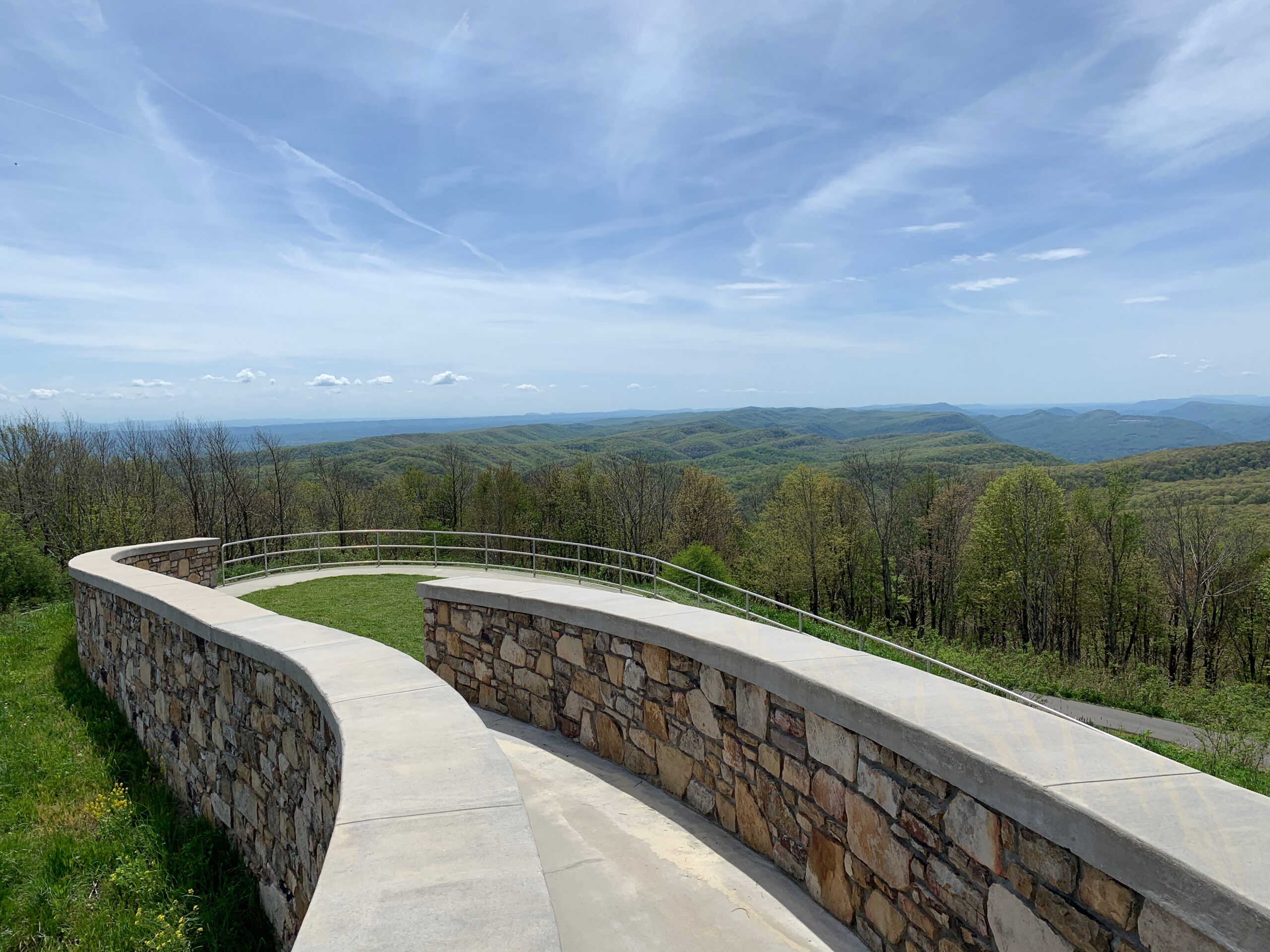
Taking a drive on the Blue Ridge Parkway is a relaxing way to enjoy Southwest Virginia’s scenic views. Exploring the parkway from Roanoke to the North Carolina border offers an opportunity take in some of the best views and visit authentic communities filled with regional culture, music and cuisine.
Water lovers
The Clinch River is ideal for kayaking, canoeing and fishing. Clinch River State Park (Alt. Rt US-58, Sugar Hill Loop, St. Paul, Virginia 24283; 276-254-5487), Virginia’s newest state park, is dubbed as a “string of pearls” along the most biodiverse waterway in this hemisphere. There are three river access point in the park, complemented by multiple public river access points upstream and downstream. Along the New River Trail’s 37 miles, the river flows through some of Southwest Virginia’s most amazing scenery. There are guides and outfitters at several locations offering gear for any excursion.
Russell Fork River at Breaks Interstate Park (Ky-Va 80, 627 Commission Circle, Breaks, Virginia 24607; 276-865-4413) is known for its world-class whitewater adventures. October is the best month for experienced kayakers to take on some of the most technical and challenging whitewater paddling in the country.
South Holston Lake stretches over miles of open water surrounded by mountain ridges. Much of the shoreline is bordered by the Cherokee National Forest, making it one of the most scenic water bodies in Virginia. The lake is popular for boating, paddleboarding and fishing and there are boat and gear rentals available at several locations.